Planning
Greater Bonne Femme Watershed Based Plan Development and Demonstration Project
Sponsoring Organization: Boone County Commission
Grant Number: G19-NPS-01
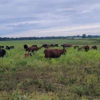
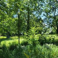
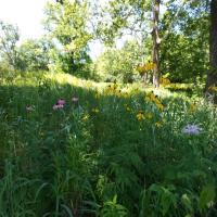
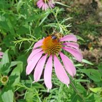
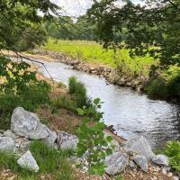
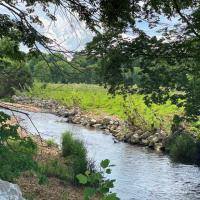
Bonne Femme and Little Bonne Femme Creeks, along with their tributaries, in southern Boone County are the focus of this project. The Greater Bonne Femme Watershed (GBFW) geographic area comprises 92.4 square miles. Major land uses include row cropping, livestock grazing, residential development, and recreation.
Currently, there are five streams in the GBFW that are on the Clean Water Act Section 303(d) list of impaired waters for exceeding the E. coli bacteria water quality standard. The watershed also includes five Outstanding State Resource streams as well as sensitive karst areas that are extremely vulnerable to water quality degradation. Additionally, the GBFW is sandwiched between two rapidly growing cities (Columbia and Ashland). The watershed includes Rock Bridge Memorial State Park and Three Creeks Conservation Area.
Major threats to stream and water quality include the collapse of stream banks; animal wastes in stormwater runoff from pastures; sediment, nutrients, and pesticides in stormwater runoff from row crops; microbial contamination from on-site sewage systems; sediments, nutrients and pesticides in stormwater runoff from residential, commercial, and industrial sites; and deforestation of riparian areas.
Project Description
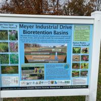
Greater Bonne Femme Watershed Based Plan Development and Demonstration project is developing a watershed based plan that contains EPA’s nine critical planning elements for the Greater Bonne Femme Watershed (GBFW) which will encompass the Bonne Femme and Little Bonne Femme subwatersheds. The plan will be developed to help improve and protect water quality in the watershed by identifying pollutant sources, identifying best management practices to be implemented, setting reachable goals and a timeline for implementation projects, and establishing an evaluation and monitoring program. Watershed modeling undertaken to provide the information needed for the plan will prioritize the E. coli impairments, but will also address other watershed concerns (e.g. sediment and nutrients) that threaten unique and vulnerable watershed resources. The project is also implementing a best management practice (BMP) demonstration project to inform the public about practices that can be installed to address the GBFW streams’ bacteria impairments. Outreach activities to garner watershed stakeholder support for the planning and implementation process will also be developed and implemented.
Objectives
- Identify the causes and sources of the pollutants in the Greater Bonne Femme Watershed
- Develop recommendations for remedies through identification of BMPs as well as critical areas for their implementation
- Estimate the costs of implementing the BMPs
- Inform the public of the need and necessity of a program to reduce pollutants in the watershed
Methods Employed
Project Products:
- Greater Bonne Femme Watershed Based Plan (EPA approved)
- Public meetings for WBP development
- Technical Advisory Committee meetings (quarterly)
- Watershed modeling and analysis
- Water quality monitoring for WBP development, tracking, and assessment
- Quality Assurance Project Plan for water quality monitoring (department approved)
- Quality Assurance Project Plan for modeling (department approved)
- Three public land management workshops
- Four volunteer water quality monitoring events
- Two water festivals
- Website development and maintenance
- BMP Demonstration Project (retrofit 2 stormwater detention basins using bioengineering design)
- Educational sign for BMP Demonstration
- Demonstration Project field day
- Quarterly Reports
- Annual Reports
- Annual FFATA and Minority Business Enterprise/Women Business Enterprise (MBE/WBE) Reports
- Final Report
Cooperating Entities
Boone County Commission, USDA Agricultural Research Service, City of Columbia, City of Ashland, Boone County Soil and Water Conservation District, University of Missouri, Missouri Department of Conservation, Natural Resources Conservation Service, and Missouri Stream Team.
Planning and Implementation
Deer Creek Watershed Initiative - Phase IV
Sponsoring Organization: Missouri Botanical Garden
Grant Number: G19-NPS-11
The Deer Creek Watershed drains approximately 37 square miles of St. Louis County. Deer Creek originates in the northwest in Creve Coeur and flows in a southeasterly direction approximately 10.76 miles before it enters the River des Peres at Maplewood. Single family homes make up 72% of the land use in the watershed. Water quality threats in the Deer Creek watershed include stormwater runoff from impervious surfaces, debris and trash, sediment from stream bed and bank erosion, and pollutants associated with combined sewer overflows, and storm sewer discharges. Sections of Deer Creek, Two Mile Creek and Black Creek are listed on the Missouri 303(d) list of impaired waters for E. coli and chloride due to nonpoint source urban runoff and storm sewer overflow.
Project Description
Deer Creek Watershed Initiative Phase IV will provide technical updates of the Deer Creek Watershed Management Plan, focusing on the impaired streams (Two Mile Creek and Black Creeks) as the main priority. The watershed plan will be updated, with particular attention paid to bringing the plan into alignment with the Total Maximum Daily Load for the watershed. The goals and objectives of the current Deer Creek watershed plan will continue to be implemented in the Phase IV project by continuing the implementation of outreach activities and BMPs that will effectively address and improve water quality impacted by nonpoint source pollution. The project will continue to use various techniques to achieve the overall goal through planning, implementation, demonstration, education, and monitoring efforts.
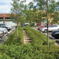
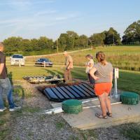
Approximately 70-75 projects will be installed through the Rainscaping Cost-Share Program during the 3-year project period. Rainscaping practices can include features such as rain gardens, bioswales, lawn alternatives, trees and shrubs, green roofs, etc., designed to slow down, soak up and reuse rainwater runoff before it carries pollutants to a local stream. Through the first three phases of the initiative, the Rainscaping program has installed over 360 projects to date. These projects currently remove 186 tons of sediment, 77 lbs. of nitrogen, and 15 lbs. of phosphorus per year from the Deer Creek watershed. Watershed modeling and water quality monitoring data will be used to calculate pollutant load reduction impacts of BMPs installed as part of the Phase IV project.
Objectives
- Decrease erosion, sedimentation, and other nonpoint source pollutants including E. coli by capturing and infiltrating stormwater runoff on-site
- Protection of streams and groundwater from chloride
- Reduce bacteria pollution in the watershed related to animal waste
- Reduce water pollution caused by plastics and other trash, yard waste and organic debris
Methods Employed
Project Products
- 1 Updated Watershed Management Plan (department and EPA accepted)
- 9 Committee meetings
- 2 draft plan reviews
- 70-75 BMPs installed in focus areas
- 20 Rainscaping cost-share signs installed (rotating through projects)
- 6 Landowner and Contractor BMP trainings
- 3 Cost-Share Application Evaluation Meetings
- 70-75 BMP ground-truthing inspections
- 3 Annual trash clean-ups
- 3 Annual honeysuckle sweeps
- 4 Seasonal water quality pollutant load reports through modeling
- 12 Quarterly Reports
- 12 Quarterly Invoices
- 3 Annual Reports
- 3 Minority Business Enterprise/Women Business Enterprise (MBE/WBE) Reports
- Final Report
Cooperating Entities
Deer Creek Watershed Alliance – Missouri Botanical Garden, St. Louis County, Great Rivers Greenway, Metropolitan St. Louis Sewer District, River des Peres Watershed Coalition, Forest Releaf, 20 local municipalities (e.g. City of Frontenac, Webster Groves and Ladue), Washington University, MO Department of Conservation, engineering firms and participating landowners.
Implementation
South Creek Restoration Project
Sponsoring Organization: City of Springfield
Grant Number: G14-NPS-03
South Creek is in the Middle James River sub-watershed which is located primarily in parts of Greene and Christian counties. The sub-watershed is the most urbanized area within the James River Watershed. There are several major tributaries of the James River located within the Middle James River sub-watershed, including Wilsons Creek and Terrell Creek.
South Creek is a main tributary to Wilsons Creek, with a watershed area of approximately 10.5 square miles. Land use is high-density urban development with approximately 25% impervious cover. Wilsons Creek is on the 303(d) impaired waters list due to low diversity of fish and aquatic invertebrate species. The cause of the impairment is listed as multiple point sources and urban nonpoint sources.
Project Description
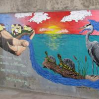
This project helped implement part of the Middle James River Watershed Management Plan. It’s focus was a one-mile long channelized segment of South Creek in Springfield. This segment was a concrete low flow channel within a vegetated floodway and approximately 49 stormwater discharge pipes conveyed via their own concrete trickle channels to the stream’s concrete low flow channel. The project purpose was to improve the water quality and stream health of South Creek by restoring the one-mile channelized segment of the stream. The project goals were accomplished through naturalizing the stream, determining the effectiveness of stream naturalization in reducing pollutant loads and improving stream habitat, and increasing public awareness and appreciation of stormwater impacts and stream health in our urban streams. The ultimate goal of the project was to equip the stream to more effectively handle and reduce nonpoint source pollutant load and improve the aquatic and terrestrial habitat by providing a natural stream environment devoid of concrete and including natural substrate, stream meandering, pools, riffles, vegetation, and trees. The area was designed with the purpose of encouraging public use via the Greenways trail and by allowing access to the stream making education a natural by-product of trail use.
By restoring the stream to a more natural hydrology while creating habitat for macroinvertebrates and a more beautiful environment, it addressed aspects of the Wilsons Creek TMDL, and implemented activities in the Middle James River Watershed Management Plan. Using existing water quality data for South Creek and assuming achieving 10% pollutants reduction, it was estimated that the load reduction that will be achieved from implementing this project would be: total phosphorus = 15 pounds/year, total nitrogen = 151 pounds/year and total suspended sediment = 3,975 pounds/year.
Objectives
- Reduce directly connected impervious area through removal of concrete trickle channels from both the main stream channel and stormwater discharge areas
- Slow down runoff velocity and provide runoff filtration through installation of vegetated stilling basins at stormwater discharge points
- Slow down stream velocity and allow for in-stream pollutant reduction through physical and biological processes that occur in a natural stream environment (devoid of concrete)
- Establish a functional riparian corridor with trees and shrubs that to: reduce the volume and pollutant loading of runoff reaching the stream, shade the stream, provide aquatic and terrestrial habitat, and encourage citizen use of the Greenways Trail and restore the riparian corridor by creating a more natural environment
- Generate public support and appreciation for protecting and restoring our urban streams by creating a functional water quality based linear park that adds value to the community by connecting people to their streams, while also providing the maximum benefit for stream health
- Promote the project benefits and how individuals can reduce nonpoint source pollution through news releases, signage, printed materials, and attendance at community events, field days, social media, and daily interactions
- Promote public participation and learning about nonpoint source pollution and stream health through volunteer work days at the project site, stormwater tour opportunities, and creative outreach programs
Methods Employed
Project Products
- Multi-Disciplinary Design Team meetings
- Quality Assurance Project Plan (department accepted)
- One Construction Plan and Riparian Plant design
- 1-mile Stream Reconstruction
- One Case Study Booklet
- Webpage Development
- Pre and Post Bird Surveys
- Pre- and Post-Knowledge Surveys
- Two News Releases
- One Temporary Sign
- Four Permanent Educational Signs (1 kiosk)
- One Groundbreaking Event
- One Ribbon Cutting Event & Tour
- Three Digital Newsletter Features
- 18 Social Media Posts
- One Fact Sheet
- One PowerPoint® Presentation
- Macroinvertebrate Monitoring Data
- Model Result/Load Reduction Report
- Copy of Contracts/MOUs
- Quarterly Reports
- Annual Reports
- Minority Business Enterprise/Women Business Enterprise (MBE/WBE) Reports
- Subrecipient Informational (FFATA) Form
- Final Report
Cooperating Entities
City of Springfield Department of Environmental Services, Ozark Greenways, Greater Ozarks Audubon, Missouri Master Naturalist, Missouri Department of Conservation, City of Springfield Department of Public Works, and Missouri Department of Natural Resources.
Monitoring
Agricultural Edge-of-Field Water Quality Monitoring
Sponsoring Organization: Missouri Corn Merchandising Council
Grant Number: G16-NPS-04
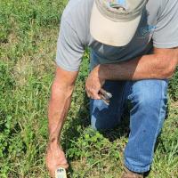
Agricultural practices are a major cause of nonpoint source pollution (NPS) in Missouri. Understanding the effectiveness of voluntary soil and water conservation practices towards reducing NPS is an important step in cultivating more widespread adoption of these practices. This project includes Section 319 grant funding for edge-of-field monitoring efforts in partnership with the United States Department of Agriculture’s (USDA) Regional Conservation Partnership Program (RCPP). This funding provides support where monitoring is not an eligible cost under the USDA RCPP.
Project Description
This project is a cooperative agreement between the department and the Missouri Corn Merchandising Council (MCMC) in partnership with the Missouri Soybean Merchandising Council with the intent to form a collaborative monitoring partnership that will conduct farm-scale edge-of-field agricultural runoff monitoring of nutrients and sediment to study the effectiveness and to demonstrate benefits of agricultural conservation practices and to support water quality efforts aimed at meeting state soil and water stewardship goals.
Edge-of-field monitoring provides a way to monitor the runoff leaving crop fields. Establishing reliable monitoring stations in a crop field allows the collection and analysis of water samples and hydrologic data to study the impact of agricultural practices as well as the effectiveness of best management practices (BMPs). Edge-of-field monitoring provides information about the amount of runoff, soil, and nutrients moving off a given field into an adjacent waterway as well as how rainfall patterns can impact these processes.
For this project, edge-of-field water quality monitoring targets regionally-representative locations from which results can be easily extrapolated. Design and site selection are key to this form of monitoring program and were developed to suit the types of questions to be answered and analyses to be conducted. In this case, data analysis is focused on substantiating nutrient and sediment loading efficiency rates of recommended (and to some degree adopted) BMPs that address nutrient and sediment loss reduction strategies such as: vegetative filter strips, riparian buffer strips, cover crops, grassed waterways, constructed wetlands, terraces, tillage, grazing, crop rotations, manure management, field borders, subsurface tile, and in some cases combinations of such practices. Data analysis from this monitoring program will also be done to inform numerical simulation(s), such as the APEX model, to support BMP recommendations as well as to document expected reduction/water quality improvement of existing BMPs.
These aforementioned BMPs have been implemented in a wide array of circumstances for the purpose of conserving soil and water integrity and improving the sustainability of production agricultural methods. In an attempt to understand the extent to which these practices have an impact, a network of 17 individual edge-of-field water quality monitoring stations were installed on seven separate farm field sites, representing typical Missouri row crop farming practices. As part of this study, a field approach has been utilized, comparing two (or more) similar fields/plots at each of the seven locations: one containing an identified BMP and the other employing conventional methods. Each station was designed to capture only agricultural runoff directly from within the crop field or directly from the outlet of a conservation practice, not water from non-cropped areas such as ditches or within streams. These 17 stations represent 10 separate paired comparisons. Each site generates runoff flow and climate data while collecting flow-weighted composite water samples during runoff events. Aside from the differences resulting from BMP implementation, all other factors pertaining to the fields/plots are as identical as possible.
Sampling is ongoing and will need to be conducted at each site for approximately five years in order to obtain a statistically significant dataset. The project sponsor provides information and updates about the project on the Missouri Corn Edge of Field Monitoring website.
Objectives
- Evaluate and verify the effectiveness of select agricultural BMPs (or combinations of BMPs) in reducing total nitrogen, total phosphorus, and total suspended solids loads
- Demonstrate potential long-term improvements in water quality and soil conservation, when possible, in areas where certain BMPs might be adopted
- Identify critical cropping system and climate variables that influence in-field soil and nutrient loading in runoff
- Collect site-specific edge-of-field water quality data that would be used to extrapolate information beyond the current sites to evaluate the extent to which large-scale adoption of BMPs positively impact water quality and associated adoption potential
Methods Employed
Project Products
- Develop project study plan and standard operating procedures
- Quality Assurance Project Plan (department accepted)
- Edge of field site evaluation and selection
- Field measurement equipment selection, preparation and installation
- BMP practice installation
- Water quality sampling/data collection
- Quarterly Reports
- Annual Reports
- Minority Business Enterprise/Women Business Enterprise (MBE/WBE) Reports
- Final Report
Cooperating Entities
Missouri Soybean Merchandising Council, Missouri Department of Natural Resources-Soil and Water Conservation Program, and participating agricultural landowners.