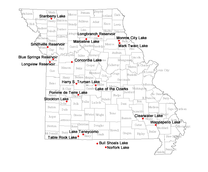
The red dots on the map below represent geographic locations of water level recording devices on lakes in Missouri. Each red dot is a hyperlink that will take you to U.S. Geological Survey (USGS) webpages presenting a time-series hydrograph illustrating recent water surface levels (provided in feet) of the respective lake.
Water surface elevations presented below are collected by an automatic recorder at each lake and transferred electronically to this webpage. Automatic recording devices can periodically malfunction. Therefore, the data presented are preliminary and may be modified prior to being entered into the permanent database.
Funding for lake level monitoring presented here is provided by the U.S. Army Corps of Engineers, USGS and Missouri Department of Natural Resources. Lake of the Ozarks is monitored by Ameren Corporation.
- Blue Springs Reservoir
- Bull Shoals Lake
- Clearwater Lake
- Concordia Lake
- Harry S Truman Lake
- Lake of the Ozarks
- Lake Taneycomo
- Longbranch Reservoir
- Longview Reservoir
- Marceline Lake
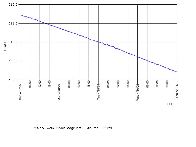
- Mark Twain Lake
- Monroe City Lake
- Norfork Lake
- Pomme de Terre Lake
- Smithville Reservoir
- Stanberry Lake
- Stockton Lake
- Tablerock Lake
- Wappapello Lake