


To view the full gallery, tap on any image.
The department’s Missouri Geological Survey provides assistance to citizens by performing geologic evaluations to aid in determining if a collapse is attributed to a natural karst feature, such as a sinkhole, or is associated with the failure of a man-made feature.
- Geosciences Technical Resource Assessment Tool (GeoSTRAT) - Locate documented sinkhole points and areas in Missouri
- Abandoned mine land emergencies - Contact the department's Land Reclamation Program
- Field Notes: Getting Recharged at Slaughter Sink – Interview with Fletcher Bone, MGS geologist by Trevor Harris
Overview
What is a Sinkhole?
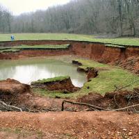
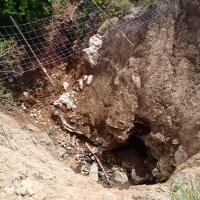
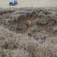
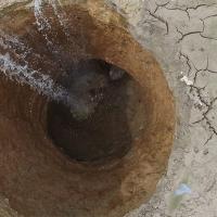
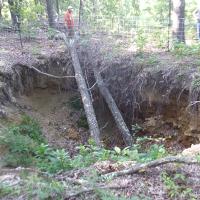
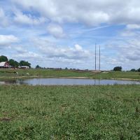
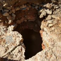
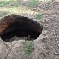
Sinkholes (also called dolines) are depressed or collapsed areas formed by dissolution of carbonate bedrock or collapse of underlying caves. The surface expression of a sinkhole is typically a conical or bowl-shaped depression or area of internal drainage. They range in size from several square yards to hundreds of acres and may be very shallow or hundreds of feet deep. Sinkholes are part of what is called karst topography, which also includes caves, springs and losing streams.
- GeoSTRAT - Display known locations of sinkholes using this ArcGIS web application
- Use the document search to locate related publications.
Facts about Sinkholes
- The department has identified approximately 16,000 sinkholes in Missouri, although, many more exist that have not been reported or documented.
- The largest known sinkhole in Missouri encompasses approximately 700 acres in western Boone County, southeast of where Interstate 70 crosses the Missouri River.
- Records are not kept about depth, but we know some are greater than 100 feet deep.
Development
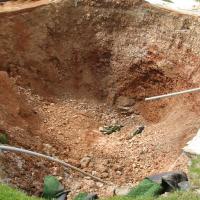
Much of the state is underlain by carbonate bedrock that has the potential for karst development. Water moving through cracks in limestone and dolomite slowly dissolves the rock and carries it away in solution. Through this process, large caves and caverns can develop in the subsurface. As rock is removed, the soil above washes into the void space. With time, sinkholes form at the surface.
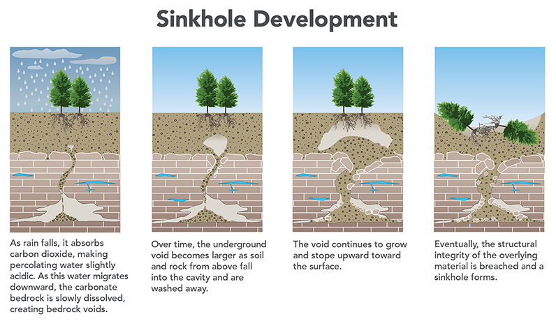
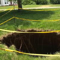
While many sinkholes occur as circular, bowl-shaped depressions, others are not readily visible on the surface because voids are plugged or capped with soil or thin layers of rock. The sinkholes begin with slow soil piping (erosion) over a long period. When the soil above the void can no longer support itself, it collapses to reveal a deep hole that connects to an underlying bedrock opening. These voids may be discovered during excavation, by drilling, or through geophysical exploration.
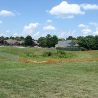
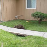
Residential and commercial development in a karst area can pose environmental and logistical problems. Aside from structurally impacting foundations of homes and other buildings, sinkholes often serve as direct conduits for rapid surface water infiltration into the underlying groundwater aquifer. Contaminants near or at the surface can quickly enter the aquifer and pollute drinking water. Increased stormwater runoff resulting from parking lots, highways, and household guttering often is diverted into sinkholes. The increased inflow of water not only can lead to the accelerated development and growth of sinkholes, but also can transport contaminants. Managing stormwater runoff and waste disposal in sinkhole-prone areas is important to maintain good groundwater quality and prevent environmental contamination.
Other Potential Causes of Collapse
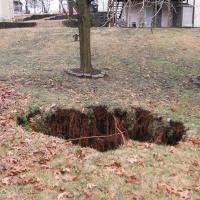
Other potential causes of collapse include man-made features such as septic tanks, cisterns, pipelines, broken utility lines, and old hand-dug wells and shallow mine workings, all of which lose their structural integrity as they age. However, unlike sinkholes, these features generally remain stable once remediated. Learn more about plugging hand-dug wells and cisterns. Learn more about mining and mine shafts.
Mitigation
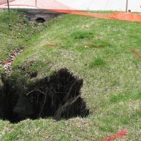
The best way to prevent damage to property from sinkholes is to identify their presence and avoid them before any land development begins; however, the exact location of where a sinkhole will develop often cannot be predicted. Once a sinkhole has developed, the landowner should erect a barrier at a safe distance to prevent access to the sinkhole. As the perimeter of the sinkhole erodes, the diameter likely will increase. Allowing a sinkhole to develop naturally is preferred. However, that is not always possible, especially in a populated area. There are procedures to properly fill and physically stabilize the void while minimizing hazard, mediating the potential for further collapse, and reducing liability. It is strongly recommended the property owner contact a professional engineer or a registered geologist for additional assistance in stabilizing sinkholes.
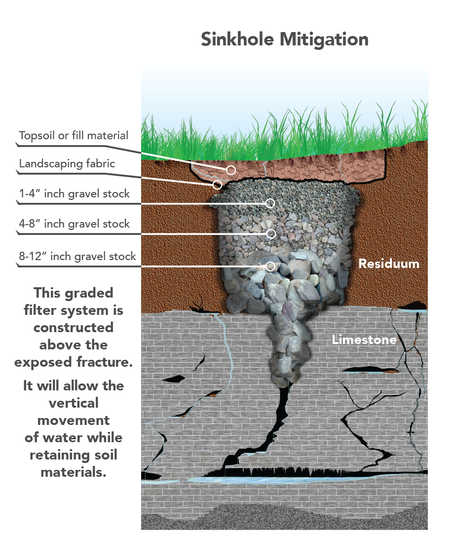
Remediating a sinkhole typically involves excavating soil materials to the bedrock surface and filling the void with size-graded material. Large rocks should be placed within and over the bedrock fracture or solution opening, with the first layer of rock sized larger in diameter than the opening. This ensures proper support is provided for overlying layers of fill. Each layer of material above the base should be successively smaller in size. Near the surface, a layer of geotextile fabric covered by topsoil may be used to complete the filling procedure. This woven material acts as a filter that allows water to pass through, but prevents infiltrating water from washing soil into the underlying fill. The area should be vegetated to help control erosion.
It is important to note that once sinkholes form, they do not go away. The sinkhole is a surface expression of a deep-seated geologic feature. The void in the underlying bedrock will continue to function as a natural drain and will transmit water and soils through the subsurface. Fill material and soils will settle over time; however, settling can be minimized using proper surface water management methods. Property owners should make every effort to limit the amount of surface water runoff near the collapse. Diverting rain gutters, limiting lawn watering, rerouting stormwater runoff and properly managing waste are simple measures that can help reduce infiltration and potential groundwater contamination.