Water level of a river rose over the tops of its banks, into the surrounding fields

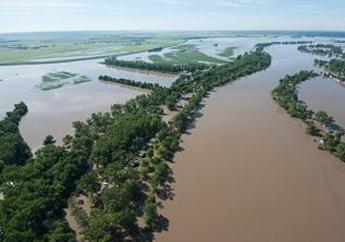
The amount of precipitation in a particular area varies from year to year, but over a period of years the average amount is fairly constant. A flood occurs when there is an overflowing of water onto land that is normally dry. Simply put, flooding occurs when the amount of water exceeds the ability of the ground to absorb it. Floods are the most common and widespread weather-related natural disaster.

A flood can occur within minutes or gradually over several days or weeks. A flood can last for several hours, days, weeks or even months. Heavy or excessive rainfall or snowmelt can cause water levels to rise over the tops of river and stream banks. Dam and flood-levee failures can send a sudden surge of water downstream, flooding areas near rivers. Paved roads, overwhelmed or plugged storm drains and limited green space reduces the amount of ground available to absorb water, which could cause flooding in towns and cities. Damaging flooding may occur with only a few inches of water to several feet.

Flash floods are the most dangerous kind of flood, combining the destructive power of a flood with incredible speed. During flash floods, water rises rapidly in a short amount of time, limiting the time available to warn and protect the public. If people are at their homes or businesses, the water may rise quickly and trap them. Flash floods have enough force to uproot trees, tear down buildings and bridges and cut out new water channels. It only takes six inches of fast-moving flood water to knock over an adult. It takes just 12 inches of rushing water to carry away most cars and just 2 feet of rushing water can carry away SUVs and trucks.

The following groups work on flooding issues affecting Missouri:

News

For watches, warnings and advisories currently in effect for Missouri, visit the National Weather Service's State of Missouri Weather Dashboard. For current travel conditions, visit the Missouri Department of Transportation's Traveler Info Map. For current flood inundation and drought extent maps, download the department's Flood and Drought Monitoring Application.

Note: When rivers or streams are at moderate or major flood levels, boating in these conditions has greater risks and dangers than during normal conditions. For the safety of boaters and to prevent impacts to local infrastructure, boating in these conditions is not recommended. When counties, towns and communities are actively conducting flood fighting activities, recreational boating in areas of active flood fights can adversely impact these efforts. 

News

  • The department will close Missouri state parks, or areas of a state park, due to road, campground or trail flooding. Be sure to check the State Park and Site Advisories map before you make plans to visit a Missouri state park.

Advisories/ Executive Orders

Assistance

Listed below are resources available to assist our communities. Additional resources are added as they become available.

City of St. Louis, St. Louis County and St. Charles County

  • The Missouri Department of Labor and Industrial Relations announced Missourians in the City of St. Louis, St. Louis County and St. Charles County whose employment was lost or interrupted due to severe storms and flooding that occurred from July 25 to July 28, 2022, can apply for up to 28 weeks of Disaster Unemployment Assistance (DUA).
  • Federal assistance is available through FEMA to eligible individuals and families. The fastest way to apply is through DisasterAssistance.gov. Other resources are also available for specific disaster declarations on FEMA's Disasters and Other Declarations webpage. Use the filters at the top of the page to find the disaster declaration that applies to your area.
  • The U.S. Small Business Administration (SBA) provides low-interest disaster loans and a variety of services to help homeowners, renters and businesses of all sizes recover from declared disasters.
  • Several flood relief and recovery resources are available on the City of St. Louis' Recovery webpage.

General

  • Disaster Resources - Take steps to prepare and learn how to respond to damage caused by flooding
  • DisasterAssistance.gov - Get a list of the closest FEMA Disaster Recovery Centers (DRCs) to find help for your immediate needs.
  • Ready.gov - U.S. Department of Homeland Security
  • Flooding - Missouri Department of Public Safety, State Emergency Management Agency

Missouri Waters

Interstate Waters

Water Levels

Hydrographs

A hydrograph shows how the height or flow of a stream is changing with time as recorded by a streamgage. They help us understand a stream and its watershed and identify both flooding and low flow conditions. The hydrographs provided for the rivers listed below reflect current conditions and precipitation amounts forecasted to occur 24 or 48 hours (at the discretion of the National Weather Service) from the time the forecast hydrograph is issued.