A construction permit to build a dam in Missouri is required for dams 35 feet or more in height. State Rules and Regulations (10 CSR 22-1) provide definitions of terms used in administration of the Missouri Dam Safety Law. Measuring the height of a dam is based on these definitions. Engineers, contractors, and potential dam owners should determine the height of the structure based on these definitions. “Height of Dam” means the difference in the elevation of either the natural bed of the stream or watercourse or the lowest point on the toe of the dam (whichever is lower) and the dam crest elevation.
Care should be taken to ensure the natural watercourse is not disturbed at the junction of the dam fill at the toe. If fill is added against the dam filling in the creek channel, a bench is created and the height determination is made where the original watercourse can be located. The following diagrams illustrate the correct locations for measuring a dam for common situations encountered in Missouri. The height of a dam generally falls into one of the following five scenarios:
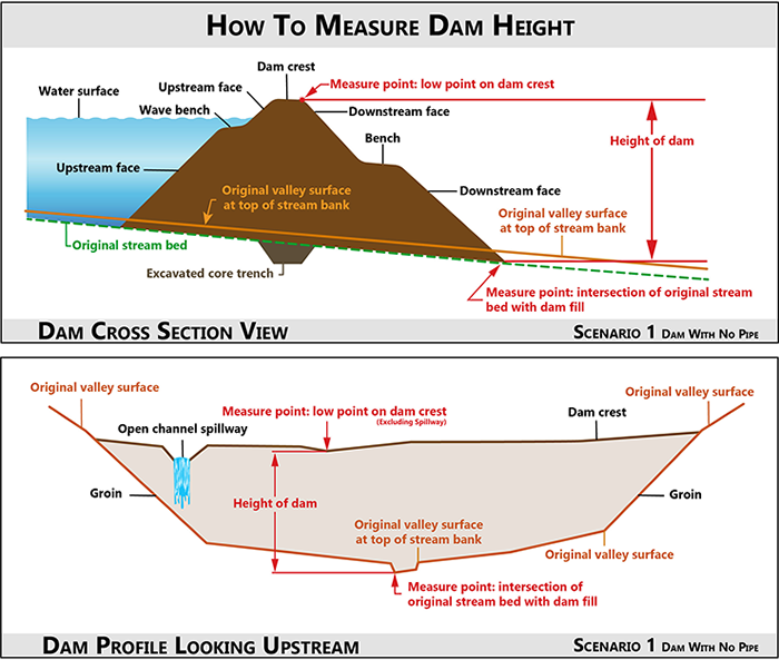
Scenario 1
The dam does not have a spillway pipe, drawdown pipe, or other appurtenant structure exiting the embankment near the toe of the dam. The height of the dam is measured vertically from the low point on the crest (excluding any open channel spillways) to the point where the embankment fill intersects the bed of the natural stream channel.
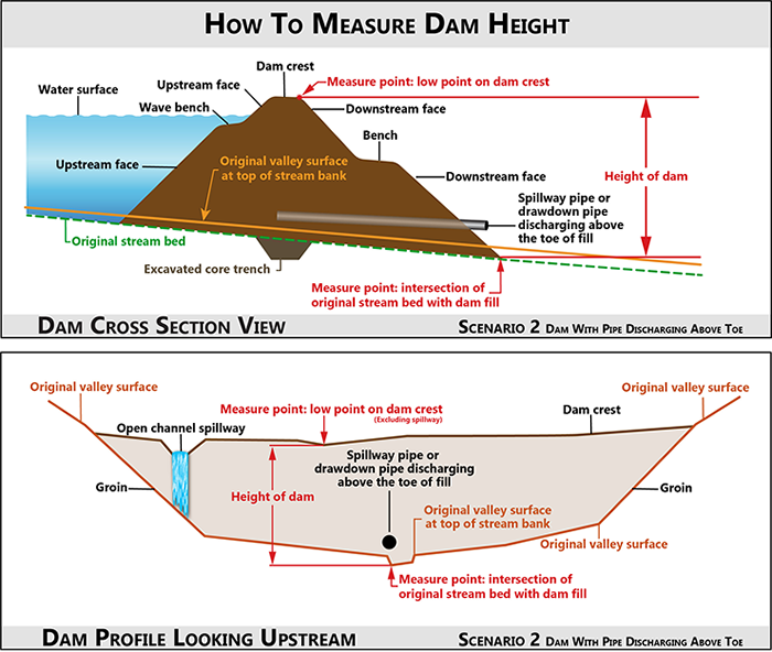
Scenario 2
The dam has a spillway pipe, drawdown pipe, or other appurtenant structure exiting the embankment near the toe of the dam but above the bed of the natural stream. The height of the dam is measured vertically from the low point on the crest (excluding any open channel spillways) to the point where the embankment fill intersects the bed of the natural stream channel.
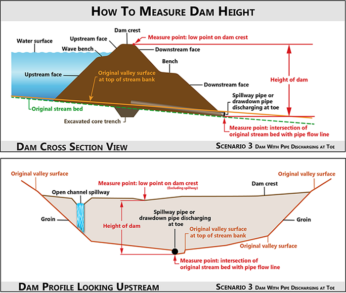
Scenario 3
The dam has a spillway pipe, drawdown pipe, or other appurtenant structure exiting the embankment at the intersection of the toe of the dam and the bed of the natural stream. The height of the dam is measured vertically from the low point on the crest (excluding any open channel spillways) to the point where the pipe flow line (invert) intersects the bed of the natural stream channel. A localized scour hole at the pipe outlet is not included in the measurement.
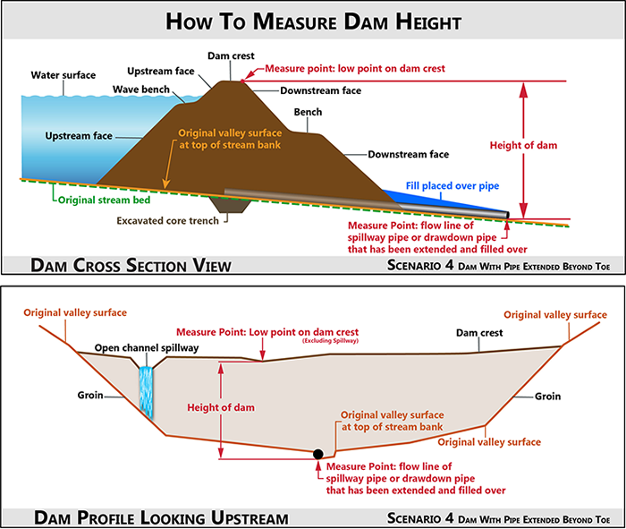
Scenario 4
The dam has a spillway pipe, drawdown pipe, or other appurtenant structure that has been extended downstream and filled over. The height of the dam is measured vertically from the low point on the crest (excluding any open channel spillways) to the point where the pipe flow line intersects the bed of the natural stream channel. This may be a considerable distance from the break in grade of the main embankment and valley fill, however, the fill over the pipe placed in the valley or streambed is considered part of the dam. A localized scour hole at the pipe outlet is not included in the measurement.
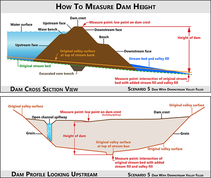
Scenario 5
The dam does not have a spillway pipe, drawdown pipe, or other appurtenant structure exiting the embankment near the toe of the dam. However, fill has been placed in the valley and the natural stream bed. The height of the dam is measured vertically from the low point on the crest (excluding any open channel spillways) to the point where the valley and stream bed fill intersects the bed of the natural stream channel. This may be a considerable distance from the break in grade of the main embankment and valley fill, however, the additional valley and streambed fill is considered part of the dam.