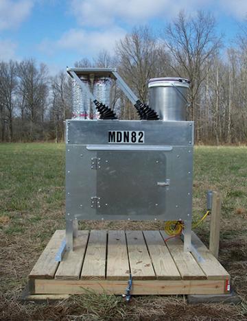
Located in the Mingo National Wildlife Refuge, this air monitor provides data to help federal and state agencies assess regional haze. It's part of a program called Interagency Monitoring of Protected Visual Environments (IMPROVE), charged with improving visibility in national parks larger than 6,000 acres and national wilderness areas larger than 5,000 acres.
Of the approximately 155 national parks and wilderness areas in the program, two are in Missouri: Mingo National Wildlife Refuge and Hercules Glades.
Pollutants
Fine Particulate Matter (PM 2.5)
Departmental information about particulate matter (PM)
- Description of two groups of particulate matter: PM2.5 and PM10
- 1997, 2006 and 2012 standards for PM2.5 plus related documents
- 2006 PM10 standard and pertinent documents
- Annual PM2.5 design values
- 24-Hour PM2.5 design values
- Map of PM2.5 sites
Technical issues can affect ability to deliver quality data. Access a table of symbols with explanation of the problems they represent.
This site does not include a continuous monitor or NAAQS compliance monitoring. Visit the following website to access data for this air monitoring site.
Hwy 51
Puxico, MO 63960
United States
Air Pollution Control Program
Division of Environmental Quality
P.O. Box 176
Jefferson City, MO 65102-0176
United States