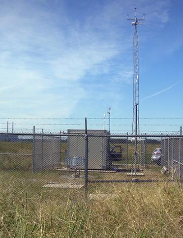
Ameren Missouri owns and operates the Valley SO2 monitoring site near its Labadie Energy Center, but the Missouri Department of Natural Resources provides quality assurance. Environmental specialists with the department conduct periodic on-site performance audits, just as they do at state-operated sites that monitor SO2. The industrial source is operating monitors at Valley and other sites under a quality assurance project plan (QAPP) approved by the department.
Working with the department, Ameren Missouri established the site in April 2015 in preparation for a proposed federal rule that gave the state two choices for characterizing air quality in areas with large sources of SO2 emissions: modeling or ambient air monitoring. In consultation with the company, the department had chosen air monitoring in this case to meet EPA's Data Requirements Rule (DRR), which was finalized in August 2015. The rule covers the third and fourth steps toward implementation of the 2010 SO2 standard of 75 parts per billion. Industry and department personnel used EPA guidelines to pick the monitoring sites; for example, they had to verify that the monitors are appropriate distances from trees, buildings and minor sources of SO2.
Data from monitors and audits will be part of EPA's Air Quality System. The federal agency will use the data collected over an initial three-year period to determine compliance with the 1-hour SO2 standard.
Pollutants
Sulfur Dioxide
EPA not only established a new one-hour standard in 2010, but it also introduced a new form for determining compliance. The new form requires three years of data — the average SO2 concentration from each hour of the year. The department and EPA calculate the design value, using the 99th percentile of one-hour daily maximum concentrations, averaged over three years.
Departmental information about sulfur dioxide (SO2)
- Description
- 2010 standard and related documents
- One-hour SO2 design values
- Four highest one-hour SO2 values year-to-date
- Map of monitoring sites
Technical issues can affect ability to deliver quality data. Access a table of symbols with explanation of the problems they represent.
2901 Labadie Bottom Road
Labadie, MO 63055
United States
Air Pollution Control Program
Division of Environmental Quality
P.O. Box 176
Jefferson City, MO 65102-0176
United States