Groundwater is one of Missouri’s most vital natural resources. Missouri's groundwater resources vary greatly across the state and are tied closely to the geology of the various regions. The state’s geology is composed mostly of sedimentary rocks like sandstone and fractured limestone and dolomite. These strata serve as substantial groundwater reservoirs. Because of this, much of Missouri contains an abundance of fresh, drinkable groundwater available for use.
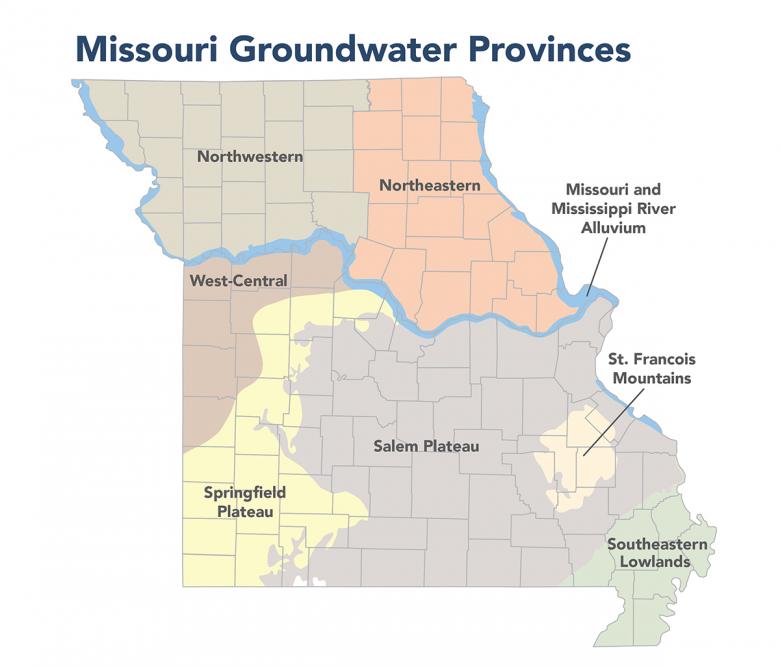
To assess Missouri's groundwater resources, the state is divided into seven major groundwater provinces and two sub-provinces. Major groundwater provinces include the St. Francois Mountains, Salem Plateau, Springfield Plateau, West-Central Missouri, Northwestern Missouri, Northeastern Missouri, and Southeastern Lowlands. The Mississippi River alluvium and the Missouri River alluvium are treated as sub-provinces. The groundwater province boundaries do not represent groundwater divides. The boundaries are drawn based on several factors, including aquifer characteristics, groundwater quality changes and aquifer boundaries. Aquifers, and thus local and regional groundwater flows, can and do cross the various groundwater provinces.
Contact Information
Natural Resource Damage Assessment and Restoration
Environmental Remediation Program
P.O. Box 176
Jefferson City, MO 65102-0176
United States