Missouri Geological Survey Director: Carey Bridges, RG
The Fishing River streamgage above Mosby is owned by the U.S. Geological Survey (USGS) and funded in cooperation with the Missouri Department of Natural Resources. Stage (water-surface elevation) measurements are made and recorded at 15-minute intervals and transmitted to the USGS office every hour. Stage and streamflow values are displayed in near real-time.
The Fishing River is located in the Central Dissected Till Plains, flowing through Clinton and Clay counties before emptying into the Missouri River in southern Ray County. The name originates from the large number of fish in the stream and the favorable fishing prospects that follow (Atchison).
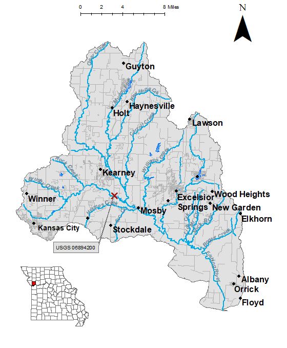
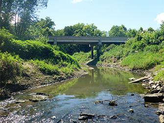
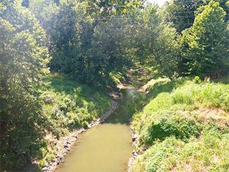
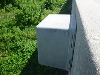
The streamgage is located at the Jesse James Farm Road bridge over Fishing River above Mosby in Clay County and consists of a shelter, a data collection platform, a pressure transducer to electronically measure stage, a crest stage gage (Figure 5) to automatically record crest height during high water events and a wire weight gage (Figure 6) used to manually verify electronic measurements. Learn how a USGS streamgage works.
Streamgage Information
- Streamgage Drainage Area: 44.4 square miles
- 10-Digit Hydrologic Unit Code: 1030010104
- Area of HUC10 Basin: 282 square miles
- Gage Location: 39°19'54", -94°20'12" (Clay County)
- Gage Datum: 780 feet above NAVD8
USGS Tools
- Average Discharge (cubic feet per second): June 30, 2007 to present
- Observation Gage Height (feet): June 30, 2007 to present
- Peak: Gage Height, Discharge (feet, cubic feet per second) 25.7 (June 26, 2015), 10,200 )May 15, 2009)
The Fishing River above Mosby streamgage webpage is maintained by USGS. Users are able to create graphs and tables utilizing the recorded parameters, which can be customized to show current and historical observations, daily data, daily statistics, monthly statistics, annual statistics, peak streamflow and field measurements for any time frame within the period of record. A location map and Water-Year Summary also are available. Customize your own data output.
Why is the Fishing River Streamgage above Mosby Important?
The streamgage provides recreational users in the area, surrounding landowners and the public with accurate stream height data. The data collected are also valuable for understanding hydrologic conditions here and downstream on the Missouri River, including drought impacts. During flood periods, the National Oceanic and Atmospheric Administration publishes a standalone forecast for this stream, and the Water Resources Center uses discharge data from this streamgage for flood, drought and water supply studies.
Much of the watershed is used for farming, but there are still recreational opportunities on the river.
In the area, people can enjoy:
- Boating
- Hunting
- Hiking
- Bird-watching
- Fishing
For more information on recreational activities located within the basin, contact the Missouri Department of Conservation.
|
|
|
|
1 REFERENCES CITED
Atchison, Anne. "Place Names Of Five West Central Counties Of Missouri." M.A. thesis. University of Missouri-Columbia, 1937.
Nothing in this document may be used to implement any enforcement action or levy any penalty unless promulgated by rule under chapter 536 or authorized by statute.
For more information
Water Resources Center
Missouri Geological Survey
P.O. Box 176
Jefferson City, MO 65102-0176
United States