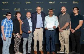
July 14 were, from left, Jen Weaver, Office of Geospatial Information; Tracy Schloss, Office of Geospatial Information; Jerry Prewett, Missouri Geological Survey; Jack Dangermond, president – Esri; as well as Mustafa Rahim, Shawn Barbie, and Ryan Rhee of the Office of Geospatial Information.
JEFFERSON CITY, MO, AUG. 3, 2023 – Missouri’s Department of Natural Resources and Office of Administration received their second Special Achievement in GIS Award at the 2023 Esri User Conference in San Diego on July 14.
Esri, a global leader in location intelligence, presented the honor in recognition of the Missouri Geological Survey’s ArcGIS Hub. The website powers more than a dozen applications sharing geologic and hydrologic information through interactive maps at no additional cost to the public. The website is available to the public gis-modnr.opendata.arcgis.com/pages/dnr-missouri-geological-survey.
“This award is a testament to effective collaboration and our team’s commitment to excellence,” said Missouri Geological Survey Deputy Director Jerry Prewett, who accepted the award at the San Diego ceremony. “Using GIS has become an essential tool for not only managing natural resources, but informing the public of our work. We look forward to innovating new ways GIS can be used to achieve our organizational goals and communicate our mission of stewardship.”
“DNR is always looking for innovative uses of GIS technology in their day-to-day business,” said Tracy Schloss, director of OA’s Office of Geospatial Information. “Making their data available to the public shows their commitment toward helping citizens and the scientific community who uses this data. Personally, I’m humbled to be recognized at this level, for what seems like going about our daily business.”
Awarded DNR project team members were Prewett and Vicki Voigt from the Missouri Geological Survey. OA project team members were Mustafa Rahim and Shawn Barbie from the Office of Geospatial Information.
In announcing the award, Esri wrote the honor is given to recognize user sites around the world displaying outstanding work with GIS technology. Successes of the Missouri Geological Survey’s ArcGIS Hub include the following:
- Geosciences Technical Resource Assessment Tool, featuring interactive maps with different statewide geologic and geotechnical datasets;
- Well Installation Section Drilling Information Map, showing well construction requirements for different areas;
- Geologic Map Index displaying different underground views based on interests, and
- Groundwater Observation Wells Interactive Map with data from more than 150 observation sites.
Additional applications of the Missouri Geological Survey’s ArcGIS Hub connect to information on everything from recent earthquakes to abandoned mine lands and public drinking water facilities.
In 2020, Missouri’s Department of Natural Resources and Office of Administration received Esri’s Special Achievement in GIS Award for development of a Katy Trail Advisory Map and an online inventory of historic buildings throughout the state park system.